Our Changing World: What the 'complex' Kaikōura earthquake taught scientists
Mon, 16th Nov 2026 (Today)Just after midnight on 14 November 2016 a 7.8 magnitude earthquake struck Kaikōura and the surrounding areas.
Starting near the North Canterbury town of Waiau on the Humps Fault, the activity spread north and north east - over 20 different faults ruptured in what is regarded as a globally unprecedented complex earthquake.
The full earthquake event lasted just two minutes, but the energy released resulted in loss of life, damage to houses and properties, landslides that took out road and rail networks and a structural change to about 120 km of the Kaikōura coastline.
A decade on, what has the Kaikōura earthquake taught us?
Complexity
If the Kaikōura earthquake were to be summed up in one word, that word would be 'complex'.
And though scientists knew about the potential of complex earthquakes to occur, this one did some very unexpected things, says Dr Anna Kaiser.
"It really jumped from faults in North Canterbury, kind of up to faults in Marlborough, which is kind of jumping across different geological regimes, if you like."
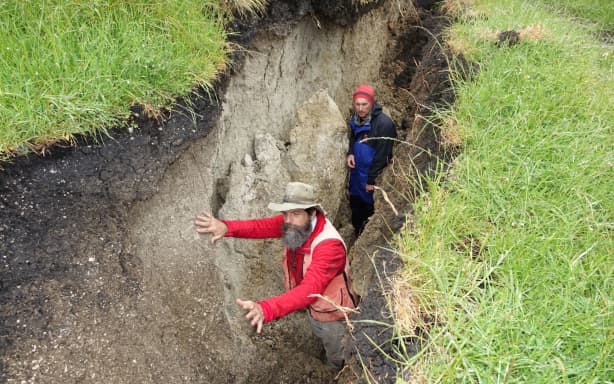
GNS scientists in the Kekerengu Fault which was one of 20 faults to rupture on the Kaikōura earthquake.
RNZ / Tracy Neal
Anna is the chief scientist of earthquake hazards at Earth Sciences New Zealand. In the days, weeks, months, and years since the quake, observations flowed in on how the faults had slipped and what the impacts had been.
Kaikōura peninsula was uplifted by about a metre, whilst north of there the coastal reef jumped by about six metres. The ground shifted sideways along the Kekerengu fault by around 10 to 12 metres along more than an 80 km stretch, while the Leader Fault shot up vertically by three metres, creating a scarp dubbed the 'Wall of Waiau'. Tens of thousands of landslides were triggered in the process, including underwater landslides in the deep canyons offshore.
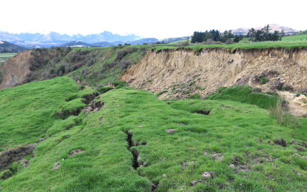
Earthquake damage on Henry Pinckney's farm.
RNZ / Maja Burry
As well as the local effects, Anna and her team were keen to understand what the findings meant for New Zealand earthquake hazards in general and to incorporate this into the National Seismic Hazard model - the science-based estimate of the likelihood and strength of earthquake shaking throughout New Zealand.
In 2022, this model was revised to incorporate a wider range of earthquakes that could happen, taking into account more complicated ruptures.
The earthquake also drew attention to the impacts of ground shaking, particularly in Wellington.
Another look at what lies beneath Wellington
Although it was over 80 km away from the earthquake, areas of Wellington city experienced intense shaking which resulted in severe damage to some buildings.
That, Anna says, is due to the 3D shape and make-up of the ground under parts of the city.
"We had an earthquake that started in North Canterbury and ruptured through to the Cook Strait and kind of directed a lot of its energy northwards. And then because of the way that it ruptured and travelled towards Wellington, you had a soft sedimentary basin in Wellington, which further sort of amplified the ground motions there."
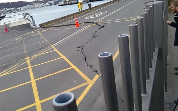
Damage to Wellington port from earthquake
RNZ / Phil Pennington
It wasn't that scientists weren't aware of the sedimentary basin under Wellington, or the potential for it to amplify ground shaking.
The basin had been mapped by a gravity survey in 1967, and events like the 1985 Mexico City earthquake had made it clear the potentially devastating impacts of combining a distant earthquake with a city built on a sedimentary basin.
Because it is underground, the basin structure can only be inferred from modelling. Small differences in the shape, angle and depth of the basin can have significant impacts on how the ground shaking gets amplified, and which buildings are most badly affected. After the Kaikōura earthquake New Zealand researchers once again looked to model the shape of the basin, using updated techniques.
Emeritus Professor Tim Stern and then Masters student Alistair Stronach decided to use the gravity survey method again, but with the latest equipment.
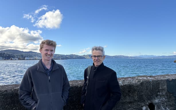
Alistair Stronach and Emeritus Professor Tim Stern at Clyde Quay Wellington
Claire Concannon / RNZ
Alistair explains that it is a method that measures the variation of gravity strength from place to place - "Gravity is not the same everywhere in the world. It only varies by very, very small amount. But if you have a very precise instrument, you can measure that."
The difference in rocks beneath your feet is one thing that impacts gravity, and is what Alistair set out to map.
That helped them model the shape and depth of the basin, which they then checked using a seismic reflection method.
Their results indicated a slightly different basin shape to that modelled by others post-earthquake, including a maximum depth of over twice as deep in an area near the stadium.
Both Tim and Alistair hope that this more 'granular' modelling of the basin shape will help prepare the city for future earthquakes.
A new configuration
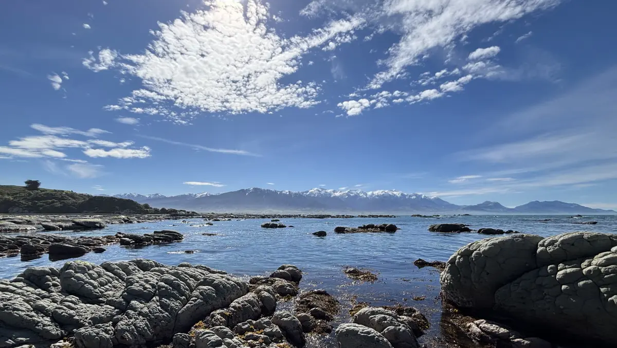
On a sunny spring day, University of Canterbury Professor David Schiel stands on the grey-white rock of Wairepo reef towards the end of the Kaikōura peninsula.
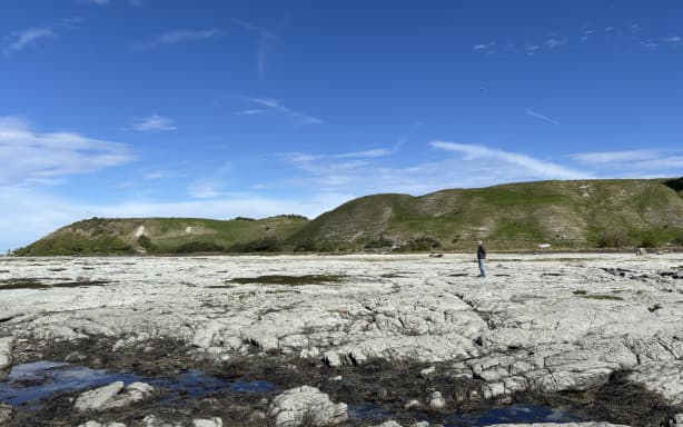
Professor David Schiel stands on Wairepo reef in Kaikōura.
Claire Concannon / RNZ
Once this large flat reef area was an important study site for dozens of marine science postgraduate students that David supervised. They had been investigating the diverse life that had made a home in the sea, under the Neptune's necklace seaweed canopy, and the impacts that tourism was having on the reef.
When Our Changing World visited just two weeks after the earthquake the seaweed was already drying out and dying. The flat reef platform had been lifted close to a metre, and the changes in tide height and temperature had made it unsuitable habitat now for Neptune's necklace.
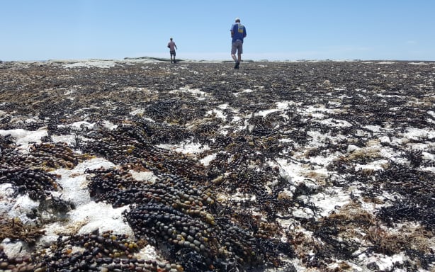
Dead seaweed litters the rocky coastal reef around the Kaikōura Peninsula, which has been left high and dry since being uplifted by a metre.
RNZ / Alison Ballance
Now a decade on, all life has gone from the rock, with remnants of what was once there hanging out in tidal cracks closer to the water's edge.
The Neptune's necklace still exists, explains David, just in much lower quantities than before.
"What's happened is that this massive reef that was covered with it is now compressed into a zone... maybe twenty centimetres of tidal height. So the species are still here, but just in nowhere near the abundance they used to be."
In the wake of the earthquake David and some of his students established study sites along the coast to assess the changes and monitor the recovery. Though recovery, David says, is a relative term - "It's a new configuration".
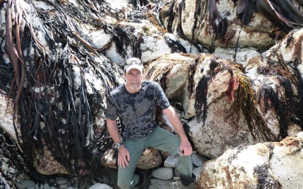
Professor David Schiel
Supplied
Extra stressors such as a marine heatwave in the summer of 2017/2018, and large amounts of sediment washing into the ocean from the earthquake-damaged catchments, meant important species like bull kelp, durvillaea, struggled to return after the earthquake.
"That was lost pretty much entirely. That species was lost over the one hundred and thirty kilometres of coastline."
The crumbling reef
With the uplift of the reef and the loss of its key seaweed inhabitants, something unusual began to happen to the rock, says David.
"Within the months after the earthquake, we'd be standing on a little promontory like that, and the whole thing would just shear off and go into powder, and literally you'd be on a rock, and the next thing you'd be on on your backside."
Measuring this change was Professor Wayne Stephenson of the University of Otago.
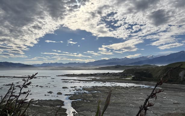
The coastline around Kaikōura peninsula experienced uplift during the earthquake, changing the reef ecology and erosion rates.
Claire Concannon / RNZ
He and his predecessor, Professor Bob Kirk, had been interested in reef platform erosion because as the reefs get worn down more wave energy reaches the base of the cliffs, causing erosion there. The study began in 1973 and the observations continued post earthquake, but with remarkable differences says Wayne.
"The platforms that had been eroding at one millimetre per year before the earthquake were suddenly eroding at two to two point five millimetres per year."
The impact was especially noticeable for the mudstone reefs, he says.
"They began to crumble really rapidly after being lifted out of the tide. They got a chance to dry out completely and just sort of fell apart."
This means that the coastal uplift, which does protect the cliffs from erosion, hasn't bought as much time as they first hoped.
"If you account for the erosion rates, the subsidence and the sea level rise, instead of having, we thought initially maybe five or six or seven hundred years of protection, we've actually got less than two hundred."
The pāua rollercoaster
Another key concern in the aftermath of the earthquake was the impact to pāua populations, as the uplift along the coast had left thousands of pāua stranded.
That's what Dr Shawn Gerrity set out to investigate for his PhD research with Professor David Schiel.
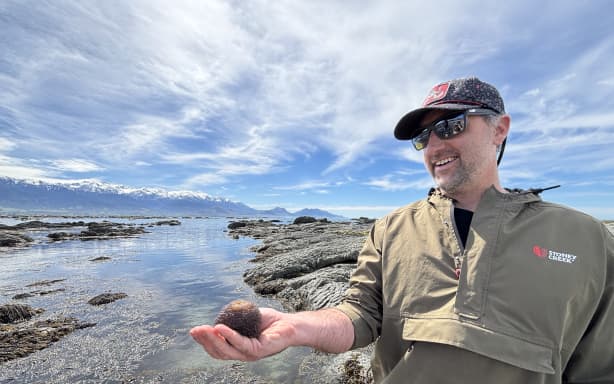
Dr Shawn Gerrity holds a wandering anemone.
Claire Concannon / RNZ
The government moved quickly to close the fishery as the concern was that the hit on the adult pāua numbers, coupled with the disruption of a key habitat for their lifecycle, would lead to long-lasting impacts on the population and slow recovery.
However, Shawn says, something remarkable happened the day after the earthquake struck.
"Abalone are known to spawn when there's natural disasters; earthquakes, tsunamis. We've seen it in Japan. And after the Kaikōura earthquake, we observed a spawning event in November, which is sort of atypical. So it was sort of like a response mechanism to a disaster... I think they kind of realized this could be it. Let's see if we can get our propagules out. We saw a synchronised spawning event all up and down the coast."
Three years later, with the fishery still closed, the results of this spawning event were clear, says Shawn.
"The abundance of juvenile pāua at every one of our twenty six sites up and down the coast was unlike anything I've ever seen. It was just every rock you turned over."
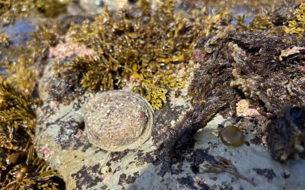
Pāua need sub and inter-tidal areas in the reef for the juvenile stage of their lifecycle.
Claire Concannon / RNZ
The fishery reopened for three months in the summer of 2021/2022 but evidence and estimates suggest that the recreational catch during that time far exceeded the five tonne allowance.
"Lessons were learned" says Dr Shawn Gerrity. "We realized that it is actually quite vulnerable to overfishing in that sort of a gold rush type environment."
"In those areas where we had good pāua next to those parking areas, the harvest rates were up to ninety two percent of the legal size."
"We did some modeling... Population size was probably contracting about fourteen percent a year, which is really significant and unsustainable even over the short term."
In 2023, the fishery reopened with different recreational catch rules, including a larger minimum size, and a reduced bag limit of three pāua per person.
Since 2024, Shawn has been a member of the Kaikōura Marine Guardians group, His role is to liaise with the Minister for Conservation on behalf of the Guardians and, he says, the new rules seem to be working well.
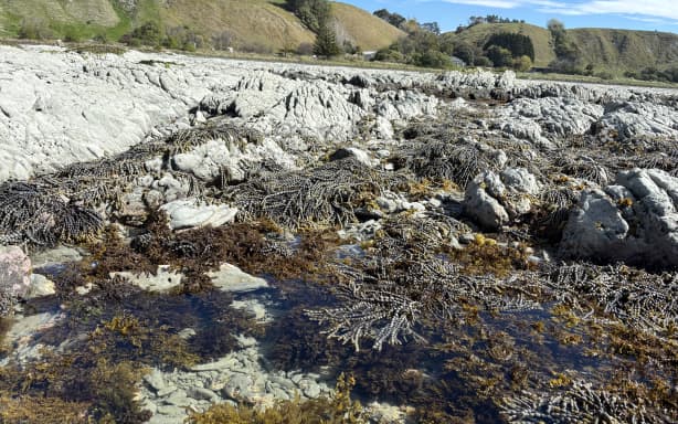
The subtidal zone at Wairepo reef where Neptune neckace seaweed still grows. It once covered the entire flat reef expanse.
Claire Concannon / RNZ
The key lesson for him, after a decade of studying this coast and its life, is that it's a pretty resilient place.
"It's healthy. You've got the deep sea trench. It's wave exposed. The water's cold. And we've learned that it can handle some really serious stressors; heat waves, earthquakes, coastal uplifts. What it doesn't handle so well is really intensive usage by humans. So that's the one thing we can manage."